Indiana Lake Depths
NESW

Old Lake

Whitley County, Indiana · IN DNR bathymetric survey
38ft Max
depth
34 acres 7 contours Public access
Paddling Index73Goodsheltered geometry · away from major roads
Get directions

Depth scale

The lake

Survey readout

Old Lake is mapped to a depth of 38 ft on the Indiana DNR survey and covers about 34 acres in Whitley County, Indiana. Depths come from the Indiana DNR survey of 2015.

Measured from the Indiana DNR lake bathymetry survey.

Deepest mapped contour
38 ft
Survey year
2015
Surface area
34 acres
Shoreline
1.16 mi · lobed
Aquatic vegetation
10% of surface · NDVI estimate
Public access
Boat Ramp · Indiana DNR site
Additional depth details7 contours
Contour depths
0–38 ft
Recorded point soundings
38 ft
Compare with another lake
Location
Whitley County, Indiana · all 8 lakes · tap a dot for that lake
Chart data

Provenance

Sources: IN DNR Lake Bathymetry, USGS 3DEP, USDA NAIP (public domain), OpenStreetMap (ODbL).

⚠ Not for navigation

Spot an error? Send a correction

Map details & sources4 sources

All layers registered to one bounding box; positions in WGS 84.

Survey-derived depth contours drape over USGS 3DEP elevation, with a USDA NAIP aerial basemap and OpenStreetMap shoreline. Color shows surveyed depth; dark lines are the survey's own isobaths.

Coordinates
41.27093, -85.55483
IN DNR lake ID
155351411
Vertical exaggeration
2.39×
Basemap
USDA NAIP · public domain
Model size
1.3 MB

Paddling

Paddling Index methodology v1.0 · calculated 2026-10-08
73 / 100GoodData confidence: High

Old Lake has a partly natural setting, well sheltered geometry, limited nearby major-road exposure. No special watercraft restriction is identified in the current source.

Why this score?5 components

Included in the index

ComponentRatingPoints of weightMeasurement
Natural settingGood18.1 of 3065% natural land cover within 150 m of shore (17% forest, 48% wetland; 21% developed)
Geometric wind exposureExcellent25.0 of 25mean fetch 455 m · 70% of sampled water within 500 m of shelter · short fetch in most directions
Watercraft controlsNone identified7.5 of 15No special watercraft restriction identified in the current DNR source. Motors permitted, subject to general law.
Public accessGood12.8 of 151 DNR fishing access site · boat ramp · ADA-accessible
Road isolationVery Good9.5 of 15limited nearby major-road exposure · 3 INDOT-classified segments within 1.2 km, peak 450 vehicles/day

Additional paddling considerations

These describe the lake but are not part of the v1 Paddling Index and do not change the number above.

Wake sensitivity
Moderate — narrow in places — wakes would carry across parts of the lake
Aquatic vegetation
Low — approximately 10% mapped coverage · NAIP aerial imagery (NDVI)
Observed motorized activity
Unknown — No lake-level measurement of boat traffic is available. Legal permission to operate motors is not evidence of use.
Wildlife habitat potential
High — 17% forest and 48% wetland cover within 150 m of shore
How this index is calculated. The Paddling Index is a relative composite derived from lake geometry and public environmental, access, roadway and watercraft-control data. It is not a user review, a safety rating, or a prediction of an individual outing. Differences of a few points should not be treated as meaningful — an 84 and an 82 are broadly comparable. Components and weights: natural setting 30%, geometric wind exposure 25%, watercraft controls 15%, public access 15%, road isolation 15%; observed motorboat activity is weighted 0% because no defensible lake-level measurement exists. Where a component has no data the remaining weights are renormalized and the confidence rating is lowered; below Medium confidence no number is shown. Sources: USGS NHD waterbody outline, USGS/MRLC NLCD Land Cover (2021), IN DNR Fishing Access Sites (motor restrictions) (2026-08), IN DNR Fishing Access Sites (2026-08) and INDOT Annual Average Daily Traffic (2021). Conditions change quickly — check current weather and local conditions before going out.

Fish you might catch

from DNR surveys

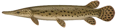
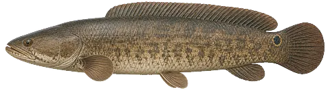
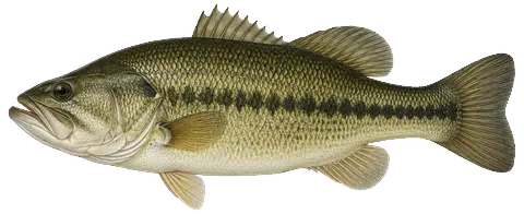
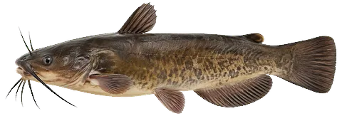
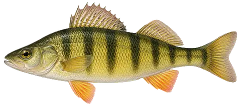
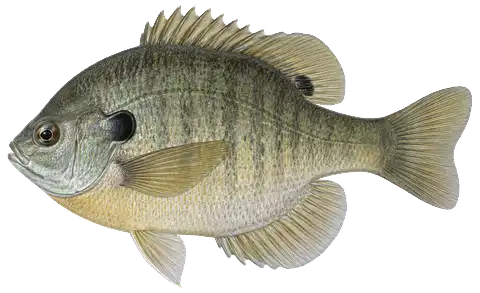
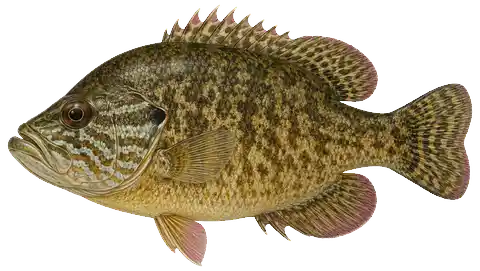
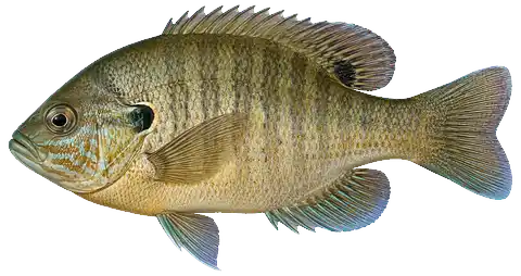
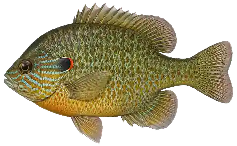
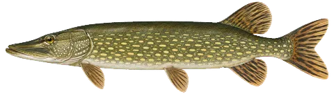
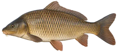
17 species with recent evidence in this lake — sized relative to each other. Illustrations are AI-generated representative adults in everyday colors, not photographs (provenance).
Fishing rules for this lake Beta

Size and daily limits for the 17 species found here — 14 open to harvest.

These are hook-and-line size and daily limit rules. The fishing code sets no closed season for these species on inland lakes, but posted property rules can close a water — see the notes. Gear, spearing and bow fishing, netting and bait collection are set by other sections of 312 IAC 9 and are not shown here.

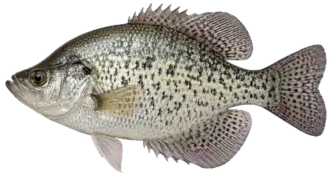
Black CrappieOpen to harvestMinimum size: no size limit · Daily limit: 25 (312 IAC 9-7-14(a)) Black and white crappie together.
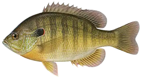
BluegillOpen to harvestMinimum size: no size limit · Daily limit: no limit (312 IAC 9-7-14(d) · “Bluegill”)
Beta. This panel is newly published. Every value is transcribed from the Indiana Administrative Code (312 IAC 9-7) and checked against the Indiana DNR's 2026-27 Fishing Regulations Guide, but the coverage and wording are still under review. If anything here disagrees with 312 IAC 9-7 or the Indiana DNR's guide, the DNR is right — the Administrative Code is the legal text; the guide summarizes it.
No closed season in the fishing code: 312 IAC 9-7 sets no season for these species on inland lakes (trout and salmon “at any time of year”, 9-7-13(d)(1)). Posted property rules can still close a water or bar entry (312 IAC 8-2-1) and 312 IAC 9-6-6 closes a few named areas, so check the property before you go. The possession limit is twice the daily bag limit (312 IAC 9-1-12.1); fish already processed and stored at your primary residence do not count toward it (312 IAC 9-2-8(d)).
Black CrappieOpen to harvestMinimum size: no size limit · Daily limit: 25 (312 IAC 9-7-14(a)) Black and white crappie together.
BluegillOpen to harvestMinimum size: no size limit · Daily limit: no limit (312 IAC 9-7-14(d) · “Bluegill”)
BowfinOpen to harvestMinimum size: no size limit · Daily limit: no limit (312 IAC 9-7-14(d) · “Bowfin”) Roe must stay intact inside the fish while on or beside the water and until processing begins; once removed, roe may not be screened, washed, processed, preserved, stored, kept, given away, sold or transported without a roe harvester's license (312 IAC 9-7-14(f), (g)).
Brown BullheadOpen to harvestMinimum size: no size limit · Daily limit: no limit (312 IAC 9-7-14(d) · “Bullhead”)
Common CarpOpen to harvestMinimum size: no size limit · Daily limit: no limit (312 IAC 9-7-14(d) · “Carp”)
Hybrid SunfishRule not confidently resolvedNot named in 312 IAC 9-7 or in the DNR guide's limits table. Please check with the Indiana DNR (317-232-4200) before keeping this species.
Lake ChubsuckerOpen to harvestMinimum size: no size limit · Daily limit: no limit (312 IAC 9-7-14(d) · “Sucker”) Greater redhorse is endangered in Indiana (312 IAC 9-6-9) and may not be taken — identify redhorse carefully.
Largemouth BassOpen to harvestMinimum size: 14" · Daily limit: 5 (312 IAC 9-7-6(a), (c)(3)) The 5 is black bass in aggregate — any combination of largemouth, smallmouth and spotted bass — not 5 of each.
Northern PikeOpen to harvestMinimum size: 24" · Daily limit: 3 (312 IAC 9-7-5(a), (b)) No more than one of the three may be over 30 inches.
PumpkinseedRule not confidently resolvedNot named in 312 IAC 9-7 or in the DNR guide's limits table. Please check with the Indiana DNR (317-232-4200) before keeping this species.
Redear SunfishOpen to harvestMinimum size: no size limit · Daily limit: 25 (312 IAC 9-7-14(c))
Spotted GarOpen to harvestMinimum size: no size limit · Daily limit: no limit (312 IAC 9-7-14(d) · “Gar”)
SuckerOpen to harvestMinimum size: no size limit · Daily limit: no limit (312 IAC 9-7-14(d) · “Sucker”) Greater redhorse is endangered in Indiana (312 IAC 9-6-9) and may not be taken — identify redhorse carefully.
WarmouthRule not confidently resolvedNot named in 312 IAC 9-7 or in the DNR guide's limits table. Please check with the Indiana DNR (317-232-4200) before keeping this species.
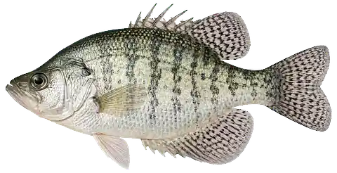
White CrappieOpen to harvestMinimum size: no size limit · Daily limit: 25 (312 IAC 9-7-14(a)) Black and white crappie together.
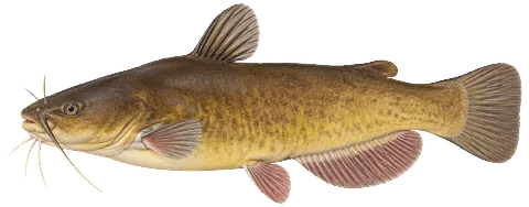
Yellow BullheadOpen to harvestMinimum size: no size limit · Daily limit: no limit (312 IAC 9-7-14(d) · “Bullhead”)
Yellow PerchOpen to harvestMinimum size: no size limit · Daily limit: no limit (IN DNR 2026-27 guide, statewide table · 312 IAC 9-7-18 (Lake Michigan only)) The code limits yellow perch only on Lake Michigan (15); the DNR's statewide table prints inland perch as unlimited.

From 312 IAC 9-7 (Sport fishing), Indiana Administrative Code (readopted 2025-03-25), and the 2026-2027 Indiana Fishing Regulations Guide · verified 2026-09-15. Regulations can change — the Indiana Administrative Code (312 IAC 9-7) is the controlling source; verify current regulations before fishing. Official regulations

Compiled from Indiana DNR fishery surveys. Silhouettes are stylized and scaled to typical adult sizes relative to one another. Presence is not a promise — fishing isn’t a sure thing.

Fishery

surveyed 2015
407Fish sampled
17Species

Gamefish Largemouth Bass 143 · Bowfin 3 · Northern Pike 1

Panfish Bluegill 172 · Hybrid Sunfish 15 · Warmouth 12

All survey species17 species

Gamefish

Largemouth Bass143 caught · to 16″
Bowfin3 caught · to 22″
Northern Pike1 caught · to 30″

Panfish

Bluegill172 caught · to 9″
Hybrid Sunfish15 caught · to 8″
Warmouth12 caught · to 10″
Black Crappie6 caught · to 11″
Redear Sunfish6 caught · to 10″
Yellow Perch4 caught · to 12″
Pumpkinseed3 caught · to 7″
White Crappie1 caught · to 4″

Bullhead & catfish

Brown Bullhead14 caught · to 15″
Yellow Bullhead13 caught · to 12″

Forage & nongame

Spotted Gar6 caught · to 24″
Sucker5 caught · to 16″
Lake Chubsucker2 caught · to 10″
Common Carp1 caught · to 28″
Length is the largest fish netted in the survey, not an angler record. Source: Indiana DNR fish survey (Indiana Data Hub) (counts summed across survey years).
Quick answers

Old Lake — common questions

How deep is Old Lake?

The deepest contour on the Indiana DNR bathymetric survey of Old Lake is 38 ft. That is the deepest depth the historical survey map records, which may differ from the deepest point of the lake itself.

How big is Old Lake?

Old Lake covers about 34 acres in Whitley County, Indiana.

What fish are in Old Lake?

Species with survey, catch or recent-stocking evidence include largemouth bass, northern pike, black crappie, bluegill, bowfin, brown bullhead. The page lists all 17 species and the evidence behind each.

Is there public access to Old Lake?

Yes. The Indiana DNR lists a public access site on Old Lake: a boat ramp with a boat dock, restrooms and ADA access. The DNR records no fee. DNR directions: "One-half mile east of Etna on CR 750N, then 1/4 mile south to Harrold Rd."