Bicentennial Pond 2
depth
Get directions
Depth scale
Survey readout
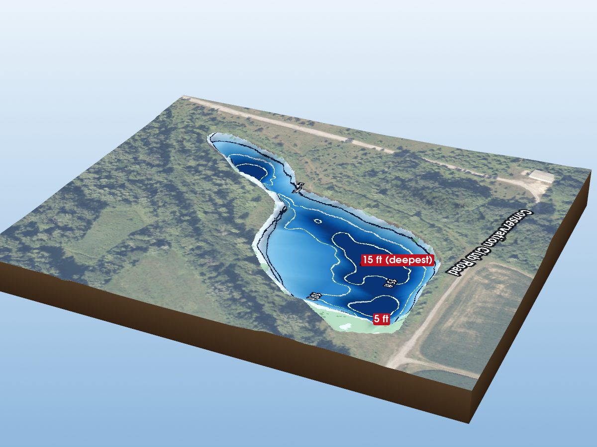
Bicentennial Pond 2 is mapped to a depth of 30 ft on the Indiana DNR survey and covers about 80 acres in Tippecanoe County, Indiana.
Measured from the Indiana DNR lake bathymetry survey.
- Deepest mapped contour
- 30 ft
- Surface area
- 80 acres
- Shoreline
- 1.54 mi · lobed
- Aquatic vegetation
- 0% of surface · NDVI estimate
- Public access
- Boat Ramp · Bicentennial Nature Park Big Pond · Indiana DNR site
Additional depth details6 contours
- Contour depths
- 0–30 ft
- Recorded point soundings
- 30 ft
Provenance
Sources: IN DNR Lake Bathymetry, USGS 3DEP, USDA NAIP (public domain), OpenStreetMap (ODbL).
⚠ Not for navigationSpot an error? Send a correction
Map details & sources4 sources
All layers registered to one bounding box; positions in WGS 84.
Survey-derived depth contours drape over USGS 3DEP elevation, with a USDA NAIP aerial basemap and OpenStreetMap shoreline. Color shows surveyed depth; dark lines are the survey's own isobaths.
- Coordinates
- 40.45097, -86.87009
- IN DNR lake ID
- bicentennial-pond-2
- Vertical exaggeration
- 2.66× below the waterline; land at true scale
- Basemap
- USDA NAIP · public domain
- Model size
- 2.0 MB
Paddling
Paddling Index methodology v1.0 · calculated 2026-09-21Bicentennial Pond 2 has a mostly natural, lightly developed setting, generally sheltered geometry, substantial nearby higher-volume roads. Watercraft controls: Electric motors only.
Why this score?5 components
Included in the index
| Component | Rating | Points of weight | Measurement |
|---|---|---|---|
| Natural setting | Very Good | 22.0 of 30 | 78% natural land cover within 150 m of shore (4% forest, 29% wetland; 13% developed) |
| Geometric wind exposure | Very Good | 20.7 of 25 | mean fetch 625 m · 11% of sampled water within 500 m of shelter · generally short fetch |
| Watercraft controls | Electric motors only | 14.2 of 15 | Electric motors only |
| Public access | Good | 12.8 of 15 | 1 DNR fishing access site · boat ramp |
| Road isolation | Modest | 0.8 of 15 | substantial nearby higher-volume roads · 17 INDOT-classified segments within 1.2 km, peak 27,136 vehicles/day |
Additional paddling considerations
These describe the lake but are not part of the v1 Paddling Index and do not change the number above.
- Wake sensitivity
- Low — wide enough that wakes disperse over most of the lake
- Aquatic vegetation
- Low — approximately 0% mapped coverage · NAIP aerial imagery (NDVI)
- Observed motorized activity
- Unknown — No lake-level measurement of boat traffic is available. Legal permission to operate motors is not evidence of use.
- Wildlife habitat potential
- High — 4% forest and 29% wetland cover within 150 m of shore
Compare Indiana lakes by Paddling Index →
Fishing rules
No recent catch, survey, or stocking data for this lake — but a fisheries order still governs it.
Fishing rules for this lake Beta
Rules that apply to this water, whatever you are fishing for.
These are hook-and-line size and daily limit rules. The fishing code sets no closed season for these species on inland lakes, but posted property rules can close a water — see the notes. Gear, spearing and bow fishing, netting and bait collection are set by other sections of 312 IAC 9 and are not shown here.
From 312 IAC 9-7 (Sport fishing), Indiana Administrative Code (readopted 2025-03-25), and the 2026-2027 Indiana Fishing Regulations Guide · verified 2026-09-15. Regulations can change — the Indiana Administrative Code (312 IAC 9-7) is the controlling source; verify current regulations before fishing. Official regulations
Non-native species records
1 recordPlants & algae

How to identify invasive species in Indiana lakes →
What does non-native mean?
USGS records identify non-native species that have been documented for this lake or its shoreline. Non-native does not necessarily mean invasive, and historical records do not confirm current presence.
Source: Midwest Glacial Lakes Partnership Conservation Planner; underlying nonindigenous species records from the USGS Nonindigenous Aquatic Species database.
Bicentennial Pond 2 — common questions
How deep is Bicentennial Pond 2?
The deepest contour on the Indiana DNR bathymetric survey of Bicentennial Pond 2 is 30 ft. That is the deepest depth the historical survey map records, which may differ from the deepest point of the lake itself.
How big is Bicentennial Pond 2?
Bicentennial Pond 2 covers about 80 acres in Tippecanoe County, Indiana.
Is there public access to Bicentennial Pond 2?
Yes. The Indiana DNR lists a public access site on Bicentennial Pond 2: a boat ramp with restrooms. The DNR records no fee.